
A Town of Tonawanda Street Directory Walkthrough
Start a street-by-street search with the delivery form of the address, then use the parcel record to attach that address to land. The useful chain is USPS normalization, Town GIS or BAS property inquiry, the parcel identifiers, the recorded deed, and a dated reverse directory. A site address identifies the parcel itself. A tax mailing address shows where a bill was sent, which may be a different place. Neither field alone proves who lives there now.
For a block or a short street segment, record the source and date beside each result. The Town map supplies geometry and reference fields. The Erie County Clerk supplies the recorded transfer trail. A library directory can provide historical occupant evidence. This order prevents a current tax owner, a mail recipient, and a person listed decades ago from being merged into one unsupported household claim.
- Use USPS address lookup to retain the street, postal city, and ZIP as delivered.
- Search the address in the Town BAS property portal, then capture its tax-map or bill clue.
- Open the Town Property & Reference Map, identify the parcel, and note the situs, mailing, parcel, and deed fields.
- Use the owner name or book/page in the Clerk index, since the land-record search does not index a street address.
- Compare a dated address section or criss-cross directory when the question concerns an earlier person associated with the street.
Note: A blank result in one source means that source did not provide the fact, not that nobody has ever been associated with the address.
Town of Tonawanda Street Directory Field Choices
The Town of Tonawanda BAS portal is a focused property inquiry rather than a broad list of everyone on a street. It accepts one search choice at a time: Bill #, Tax Map #, Property Address, or Owner Name. For an address, enter the street number and name but leave off the suffix. For an owner search, leave off a middle initial. Those small input rules matter when a direct search first returns no match.
| Field or attribute | Use in an address search | Format or limit |
|---|---|---|
| Bill # | Find a tax-bill record | Use one BAS search mode |
| Tax Map # | Bridge to a mapped parcel | Use one BAS search mode |
| Property Address | Locate a specific parcel | Number and street name, omit suffix |
| Owner Name | Find an owner-linked property record | Omit middle initial |
| SWIS, PARCELID, PrintKey | Keep parcel research stable | GIS identifiers, not a verified BAS input |
When the portal does not provide a usable street-wide result, move to map browsing instead of forcing a name search. Search a known address, identify its parcel, and follow the street parcel by parcel. The BAS result is a lead into assessment and tax material. It is not a certified deed and it does not create a list of current occupants.
Town of Tonawanda Street Parcel Attributes
The Town GIS parcel layer is the strongest local reference tool for reading a street in context. Its fields include SWIS, PARCELID, PrintKey, OWNER1 and OWNER2, MAILAD fields, SITEADDRESS and LOCALZIP, deed date, book and page, assessed values, tax components, building details, neighborhood code, and zone code. A parcel can also carry sale data, school coding, fire or police context, and a physical-address field. Save only the fields that answer the question at hand.
The Town parcel-layer service shows the public schema behind the map.
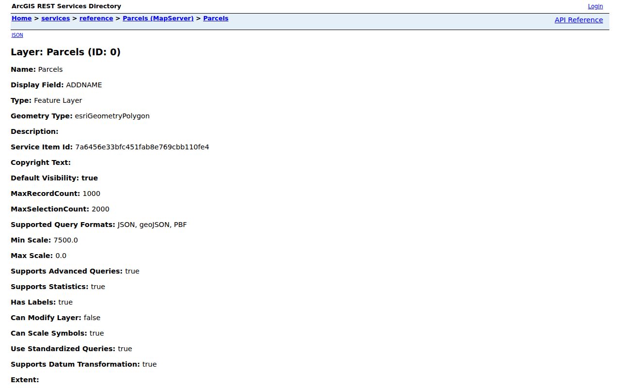
The layer makes it possible to compare the physical situs with the owner mailing field, deed reference, and map identifiers before moving to the recorded document.
- Parcel
- A mapped unit of land used for tax and reference work. A parcel can change through a split or merger.
- Situs address
- The physical address assigned to the parcel. It is different from a tax-mail address.
- Plat or map reference
- A subdivision or map identifier that helps connect the parcel to the legal record.
- Criss-cross directory
- An address-arranged directory section that can show a person or business listed at a location in a particular edition.
The map is public and read-only. It supports identify, selection, geometry, and printing, but it is not a legal survey or proof of present occupancy. If the map and a deed disagree, preserve both dates and verify the recorded instrument.
Town of Tonawanda Street Labels and Postal Terms
Town of Tonawanda, City of Tonawanda, Village of Kenmore, and USPS labels can appear side by side in local research. The public Town GIS legend includes 14150, 14207, 14217, and 14223, while a separate reference-layer listing exposed three of those coded ZIP values. That is a reason to confirm the final mailing form one address at a time, not a reason to assign an entire street one municipal or postal label.
A directory may use Tonawanda Township, Tonawandas, Buffalo Northeast Suburban, or Erie County Suburban. The Clerk Town filter is an index jurisdiction filter, not a postal-city filter. Keep the printed historic label, the USPS form, the parcel situs, and the legal description in separate columns. This avoids treating a Buffalo, Kenmore, or Tonawanda postal line as a municipal finding.
Deed Bridges for a Town of Tonawanda Street
Erie County Clerk Browser View is party and document based, not address indexed. First use the parcel record to obtain the current owner and deed book/page, then search the Clerk by book/page or by party. Party names are entered last name first, without a comma. The interface also offers Town, date range, document type, and direct-name filtering. Search spelling variants, then use the legal-description and parcel clues to rule out another property with a similar owner name.
The online deed index begins January 1, 1986, and deed images begin January 1, 1960. Earlier work can require the Graves Index, older books, a public terminal, or a Clerk request. The index result can expose party labels, instrument number, recorded date, book/page, consideration, parcel or map details, legal-description lines, and document status. Keep any replaced, correction, or not-verified notation with the record.
The Erie County Clerk records landing page explains the available access modes.
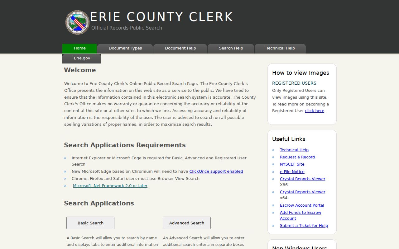
That landing page is the starting point for the Clerk’s web system, while Browser View supplies the party, instrument, book/page, parcel, and legal-description routes that an address cannot use directly.
Note: A deed establishes a recorded transfer, while a current GIS owner field can lag a recent conveyance.
Historical Street Directory Labels
For a past street directory, the Buffalo & Erie County Public Library guide identifies Tonawanda Township runs for 1900/01, 1913, 1922, 1924, 1928, and 1930 through 1942. The regional Tonawandas holdings are 1948, 1951, 1952/53, 1955, 1957, 1958 through 1981, 1983, 1985 through 2000, 2000 through 2004, and 2007. The gaps matter. Do not turn an unlisted year into a continuous roster.
Use an address or reverse section when that edition has one, then compare the name section and nearby entries. The Grosvenor Room keeps the directories as reference material, and closed-stack items may need 10 to 15 minutes for retrieval. The library can also make up to five targeted directory or telephone lookups through its request form. For a deeper explanation of the holdings themselves, the Town of Tonawanda city directory collections page separates the editions from current address records.
Town of Tonawanda Street Records by Source
Each address-keyed source answers a different question. A property field points to tax and parcel facts. A deed identifies the parties and legal record of a transfer. A historical directory places a listed person or business at an address for an edition year. Keep those roles distinct when building an address-research note.
| Record set | Keeper | What it can show | Access route |
|---|---|---|---|
| USPS address and ZIP | USPS | Delivery formatting and postal city | Address-by-address lookup |
| Tax and assessment | Town BAS and Erie RPTS | Owner, tax-map, bill, values, situs | Property inquiry and tax-map route |
| GIS parcel | Town GIS | Parcel geometry, map fields, zones, districts | Read-only map and query |
| Deed or mortgage | Erie County Clerk | Transfer parties, legal description, book/page | Index, terminal, copy, or request |
| Reverse directory | Buffalo & Erie County Public Library | Dated address and directory listing | Reference or available digitized route |
| Permit or code record | Town Code Enforcement | Work, inspection, or owner-agent references | Office or narrow FOIL request |
The combination is useful because a parcel ID and legal description can outlast a changed street format. A missing directory entry can reflect an edition gap or the absence of an address section. A missing Clerk result can reflect an indexing variation. Record what each source did and did not provide before deciding that a street trail has stopped.
Town of Tonawanda Street Voter Boundaries
The NYS Voter Lookup is a self-service tool for a voter to check registration, poll-site, or mail-ballot information. It asks for county, name, date of birth, ZIP, and address inputs. It is not a browseable street roster and cannot be used to infer that a person who does not appear is not a resident. Registration describes an election relationship, not ownership or household composition.
Erie County Board of Elections public-file requests use a different route. The request must state an elections purpose and include the required certification under Election Law §3-103(5). Protected data, including confidential registrations, stays out of ordinary public output. A geographic request can be framed by Town, ward, or district, but it should not become a street-by-street publication of personal data.
Town of Tonawanda Street Records by Request
No official online Town permit index was located. For an address-specific permit, inspection, certificate of occupancy, or code question, use the Town FOIL route with a precise address, tax-map number if known, date range, record type, and requested delivery method. The form includes fields for the address of records, description, request details, and release method. FOIL can result in redaction or denial where an exemption applies.
New York Freedom of Information Law, Public Officers Law Article 6, generally requires an agency to respond within five business days or acknowledge the request and give a reasonable date. The usual copy charge is up to $.25 per page for pages no larger than 9 by 14 inches, or actual reproduction cost. That access rule does not convert private data into a street list.
Town of Tonawanda Street Directory Limits
A public parcel is not a household census. Owner names, mailing fields, and deed parties are record-specific facts, not a complete list of everyone at an address. Utility accounts, delivery records, and general DMV address data are not public street-directory sources. The federal Driver’s Privacy Protection Act restricts motor-record information. New York’s Address Confidentiality Program and protected voter registration also keep qualifying physical addresses out of ordinary lookup paths.
A dated directory, census entry, or court filing should be described with its date and source. Do not carry it forward as a current finding. Where a legal ownership question matters, seek the recorded instrument or a certified copy from the custodian instead of relying on a map label.
Lawful use. Address research is for lawful personal, family-history, civic, or property questions. Repeatedly using records to monitor, threaten, or contact someone can violate New York Penal Law §120.45 or §240.26.