
Town of Tonawanda Neighbors by Block Source
A block-level search is a comparison of mapped parcels and dated records. The Town GIS is the first place to orient the search because it shows parcel boundaries and reference fields. The property inquiry and Clerk index add details, but neither creates a complete resident list. For an older block, a reverse directory can be a better source than a current owner field when the edition contains an address section.
| Source | What it shows about a block | Access |
|---|---|---|
| Town parcel GIS | Boundaries, owner and mail fields, situs, values, deed and building references | Public read-only map and query |
| Town Property & Reference Map | Parcels, building footprints, streets, zoning, districts, ZIPs, and mapped watch areas | Public map service |
| Town BAS inquiry | Bill, tax map, property address, or owner-linked property lead | One search choice at a time |
| Erie County Clerk | Recorded parties, transfer details, legal descriptions, map or parcel clues | Party, instrument, book/page, parcel, or legal-description search |
| Library reverse directory | Dated persons or businesses associated with address entries | Reference, request, or available digitized access |
| Board of Elections file | Lawfully requested election fields by geographic area or district | Elections purpose, certification, and protected-data limits |
A GIS owner field, a tax-mail address, a deed party, and a dated directory listing should remain separate columns in any block note. A current parcel has an owner-related reference field. It does not prove who occupies the parcel, how many people are there, or whether a person belongs to a neighborhood group.
Map a Town of Tonawanda Block From One Parcel
The adjacent-parcel method is map first. Normalize the target through USPS, open the Town Property & Reference Map, and turn on Tax Parcels. Building Footprints, Neighborhood Watch, and ZIP layers can add context without changing the parcel boundary. Identify the target polygon, then pan along shared edges and identify each adjoining polygon. The right description is adjacent parcel or nearby mapped parcel, not neighbor household.
- Confirm the delivery address and postal label with USPS, retaining that label instead of silently changing it to a municipal name.
- Locate the target in the Town GIS and identify its parcel polygon.
- Record the parcel ID, situs, owner and mailing distinction, deed book/page, neighborhood, and zone fields that the map provides.
- Pan across shared boundaries and repeat the same limited capture for each adjacent parcel.
- Use the book/page or party name in the Clerk system only when a recorded-transfer question needs an answer.
For a full named-street chain rather than an immediate block view, use the Town of Tonawanda street directory workflow. It adds USPS normalization, BAS input rules, deed bridging, and directory years without turning map results into a household roster.
Note: The map service supports identify, selection, and geometry queries, but it is read-only and is not a legal survey.
Town of Tonawanda Neighbor Map Context
The Town GIS stack puts each parcel in a broader physical setting. Available reference layers include parcels, building footprints, streets, zoning, school districts, fire districts, police beats, municipal boundaries, ZIPs, census geography, parks, waterways, and Neighborhood Watch. A building footprint may describe a structure. A zoning label describes mapped land use. A school or police layer describes a service geography. None is a household list.
The Town GIS reference legend identifies the public layer categories used for this context.
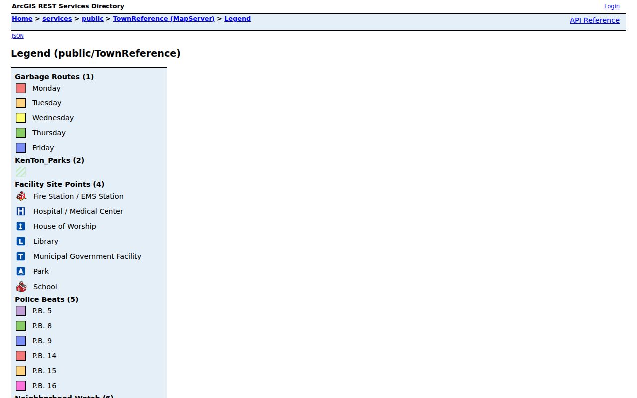
The legend helps distinguish a parcel boundary from a neighborhood-watch polygon, ZIP label, public-service district, or other reference layer that happens to cover the same area.
Town of Tonawanda Neighborhood Watch Labels
The mapped Neighborhood Watch layer uses nine labels: Alexander Hamilton, Belmont, Deerhurst, Fries/Brighton, Lincoln Park, Lindbergh, Old Town, Sheridan Parkside, and West Girard. These are official map labels for areas, not proof of association membership. The research found no verified HOA roster, umbrella organization, or member directory for the Town, so no resident name should be inferred from a label or a parcel inside one of these areas.
| Community context | Verified public role | What was not verified |
|---|---|---|
| Town GIS Neighborhood Watch | Mapped areas with the nine official labels | Association membership or resident roster |
| Buffalo & Erie County Public Library | Local-history referrals, directories, maps, clippings, and genealogy collections | That a referred collection contains a particular person |
| Historical Society of the Tonawandas | Local-history contact at 113 Main Street, Tonawanda, NY 14150, 716-694-7406 | Research policy, fees, or a public member list |
The library’s referral network can point to diocesan, ethnic, and genealogy collections for community context. Ask each repository about finding aids, years, copying, privacy, and staff research before expecting a name search. A public contact point is not a membership directory.
Adjacent Parcels Are Not Town of Tonawanda Households
Public parcel data can show a mapped lot, owner field, tax-mail destination, assessed values, deed and sale metadata, building characteristics, and zone or neighborhood codes. The owner mailing address may point out of town, to a representative, or to a tax-bill destination. It is not evidence that the owner lives at the situs. The same caution applies to a deed party. A grantor or grantee is a party to the transfer, not an automatically current occupant.
For a defensible block note, use columns for parcel ID, street number and name, ZIP, municipal or postal label, owner field, mailing city and ZIP, deed book/page, sale or deed date, zoning, school, fire, police, watch polygon, and adjacent parcel IDs. Do not publish unnecessary contact fields. A blank field means that a source did not supply it.
Erie Deed Records Around Town of Tonawanda
The Erie County Clerk search is not address indexed. After mapping the parcel, use the owner name, book/page, instrument number, parcel, map, or legal-description clue to locate a recorded document. Browser View accepts a party name as last name first without a comma and offers Town, date, document type, and direct-name filters. Search results can contain party labels, recorded date, consideration, legal-description lines, map or parcel identifiers, and status notes.
Erie County’s public GIS viewer provides a county-level mapping counterpart for parcel and reference context.
The county viewer can add broad mapping context, but the recorded Clerk instrument remains stronger where an ownership or transfer detail is disputed.
Online deed indexing begins January 1, 1986, and deed images begin January 1, 1960. Older work can require the Graves Index, book and page, a public terminal, or a Clerk request. Never substitute a street search for those documented access routes.
Older Town of Tonawanda Neighbors by Directory
Current map adjacency says nothing by itself about a block in 1930, 1950, or 1985. For an earlier block, use a reverse directory edition when available, a census enumeration, and an individual parcel deed chain. The library’s named Tonawanda Township runs are 1900/01, 1913, 1922, 1924, 1928, and 1930 through 1942. The Tonawandas runs then include 1948, 1951, 1952/53, 1955, 1957, 1958 through 1981, 1983, 1985 through 2000, 2000 through 2004, and 2007.
Those editions contain gaps and regional labels. A directory heading can say Tonawanda Township, Tonawandas, Buffalo Northeast Suburban, or Erie County Suburban. Compare printed street wording, cross streets, parcel keys, and census date before treating two entries as the same place. The federal census is public through 1950, but a census household remains an enumeration-date fact rather than a current finding.
Comparing Town of Tonawanda Neighbor Tools
Official sources make their limits easier to see. Commercial neighbor tools are an unnamed category that may combine parcels, directories, marketing material, and inferred associations. Such compilations can be stale, merge similarly named people, or hide their source dates. They should be checked against the actual custodian record rather than treated as an authority.
| Source type | Strength | Important limit |
|---|---|---|
| Town GIS and BAS | Current parcel and reference context | Owner or mailing field does not establish occupancy |
| Erie Clerk record | Recorded transfer, party, and legal-description evidence | No address index; images and older records have access limits |
| Library directory or census | Dated person or household context | Edition gaps, historic labels, and date limits |
| Commercial neighbor category | May offer a fast lead | Accuracy, source dates, and matching method may be unclear |
Erie County Internet Mapping describes the County’s public mapping framework and parcel-layer context. Use map data to orient a focused question, then check the controlling record for the specific fact.
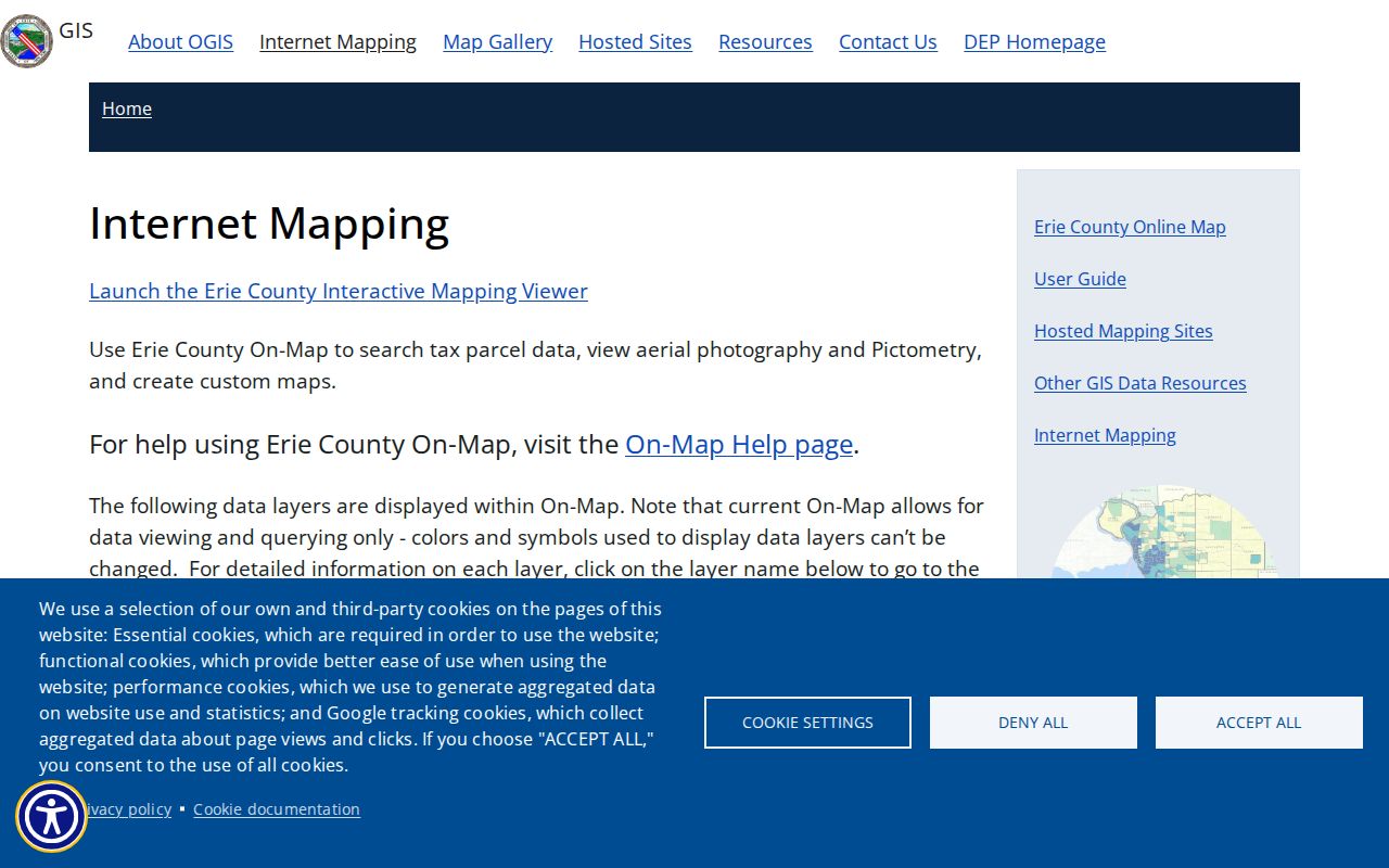
The County mapping material is useful for context such as aerial, floodplain, wetland, school, and ZIP layers, not for identifying a complete household.
Town of Tonawanda Neighbor Lookup Limits
New York’s Address Confidentiality Program shields qualifying physical addresses, and Election Law §5-508 protects confidential voter registration. The NYS Voter Lookup is a self lookup, not a public street roster. Erie Board of Elections file requests are limited to an elections purpose under Election Law §3-103(5), require certification, and exclude protected information. Utility customers, delivery records, general DMV address data, and unlisted contact information are not public workarounds.
A postal city can also differ from the Town jurisdiction. Keep the USPS label, Town or City or Village label, parcel situs, and Clerk filter separate. If a map result is broad, narrow it by geometry or map extent and retain the query date. Public geography should never be used to monitor a person.
Lawful use. Use block records for lawful personal, civic, or local-history questions. Using maps or records to watch, threaten, harass, or repeatedly contact someone can violate New York Penal Law §120.45 or §240.26.